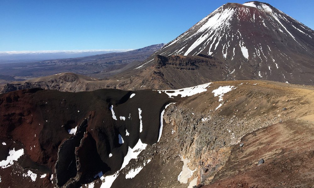
Highlights
A full-day self-guided hike on the Tongariro Alpine Crossing track (Mangatepopo to Ketetahi) inside Tongariro National Park — the track itself is free to walk.
About this experience
The Tongariro Alpine Crossing is New Zealand's most famous day hike — a 19.4 km point-to-point alpine track across an active volcanic landscape of red craters, emerald lakes, steam vents and wide mountain views. It's stunning but serious: a full-day, exposed hike at altitude where conditions can change fast, so most visitors tackle it in the main hiking season using a pre-booked shuttle rather than trying to self-drive and park at both ends.
What's included
- A full-day self-guided hike on the Tongariro Alpine Crossing track (Mangatepopo to Ketetahi) inside Tongariro National Park — the track itself is free to walk.
- Typically, a one-way shuttle transfer from accommodation hubs such as National Park Village, Whakapapa, Turangi or Taupō to the trailhead and/or back from the finish (when you book with a shuttle operator).
- Formed walking track with boardwalks, steps, marked poles and signposts across the main route, plus DOC (Department of Conservation) information boards at key points.
- Access to classic landmarks like Soda Springs, South Crater, Red Crater, Emerald Lakes, Blue Lake and the long descent through tussock and forest near Ketetahi.
- NOT included: food, water, clothing, hiking gear, guide (unless you specifically book a guided trip), travel insurance, parking at shuttle pick-up points, or any winter alpine equipment.
Who it's for
- Best for fit, prepared hikers comfortable with 6—9 hours of continuous walking, steep climbs and long descents on uneven, rocky terrain.
- Suitable for adults and older teens with good fitness; many families do it with active teenagers, but it's not a casual sightseeing stroll.
- Works well for independent travellers who like big scenery and don't mind early starts, strong wind, cold temperatures and occasionally crowded trails.
- In winter or poor conditions, the Crossing should only be attempted with proper alpine gear and experience, or on a guided trip with qualified guides.
- Not suitable if you have poor fitness, serious knee/ankle issues, heart or breathing problems, a strong fear of heights on exposed sections, or if you dislike cold, wind and long days on foot.
What you'll do
- Wake early and meet your shuttle in National Park Village, Turangi, Taupō or another base town, or park at the designated car park and board the shuttle to the Mangatepopo trailhead.
- Start hiking from Mangatepopo car park, following a gently rising valley past boardwalks and Soda Springs, then climb the steeper Devil's Staircase towards South Crater.
- Continue up to the exposed Red Crater ridge, the high point of the Crossing, with views across volcanic cones, lava flows and out towards Lake Taupō on a clear day.
- Descend carefully on loose scoria to the brilliantly coloured Emerald Lakes, then traverse past Blue Lake before beginning the long, gradual descent towards Ketetahi.
- Walk down through tussock slopes and re-growing forest, passing steam vents and lahar warning signs, until you reach the Ketetahi trailhead and car park.
- Meet your pre-booked shuttle at the end (or walk to your parked vehicle if you've arranged your logistics that way) and return tired but satisfied to your accommodation for food and recovery.
Before you go
- Tickets / price (starts from): the Crossing itself has no entry fee, but in practice most visitors pay for a shuttle. Typical adult shuttle prices sit in the rough 60—80 NZD per adult range depending on departure town and operator; budgeting about 65 NZD per adult for a standard return/pick-up shuttle is realistic.
- Time & distance: the official track distance is around 19—20 km, with most reasonably fit people taking 6—8 hours of actual walking plus breaks. You must start early enough to finish in daylight and meet your shuttle pick-up time.
- Weather & season: conditions can change quickly — strong wind, rain, snow and low cloud are common. The main hiking season is roughly late spring to autumn; in winter, ice, snow and avalanche risk mean you need alpine skills/equipment or a guided trip.
- Fitness & gear: you must carry sturdy hiking footwear, warm layers (including a windproof/waterproof jacket), hat, gloves, sun protection and at least 2—3 litres of water, plus enough food for a long day out.
- Safety rules: always check DOC Tongariro Alpine Crossing alerts before you go; obey all track closures, volcanic hazard warnings and shuttle company advice. Turn back if conditions deteriorate or you are struggling early in the day.
- Parking & access: parking time limits and restrictions apply at some car parks during peak season; most visitors are required or strongly encouraged to use shuttle services rather than leaving cars at both ends.
Good to know
- Location: the Crossing is in Tongariro National Park in the central North Island, roughly 1 hour from Taupō by road and close to National Park Village and Turangi.
- Time needed: treat it as a full-day commitment of 8—10+ hours door to door, including shuttle transfers, track time, breaks and post-walk logistics.
- Crowds: this is a very popular hike in peak season; expect crowds and a steady flow of people on good-weather days. Midweek and shoulder-season days can be quieter.
- Toilets & water: basic toilets are available at the start, key points along the track and at the end; there are no reliable treated water sources, so bring all the drinking water you need.
- Alternatives: if the full Crossing is too much, consider shorter walks in Tongariro National Park like Taranaki Falls, Tama Lakes or shorter alpine tracks from Whakapapa Village.
Why this is worth it
Budget around 65 NZD per adult for a shuttle (the track itself is free) and 8—10+ hours door to door for the Tongariro Alpine Crossing — a serious but spectacular 19 km alpine day hike across an active volcanic landscape of craters and emerald lakes that demands good fitness, solid gear and respect for rapidly changing mountain weather.